


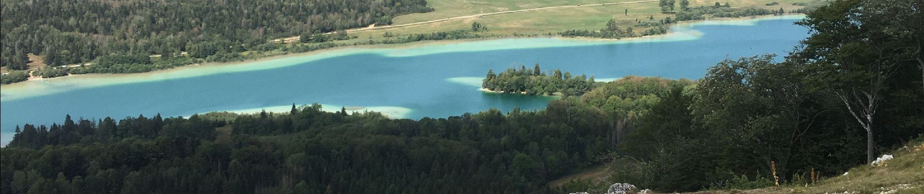
Le belvédère des 4 lacs

ash
User

Length
14.4 km

Max alt
991 m

Uphill gradient
378 m
Km-Effort
19.4 km

Min alt
748 m

Downhill gradient
374 m
Boucle
Yes
Creation date :
2020-08-12 07:42:56.0
Updated on :
2020-08-15 12:36:21.983
4h06
Difficulty : Difficult

FREE GPS app for hiking
 SityTrail
IGN / Geographical institutes
SityTrail Plus
The world is yours!
About
Trail Walking of 14.4 km to be discovered at Bourgogne-Franche-Comté, Jura, Le Frasnois. This trail is proposed by ash.
Description
PR33
Photos


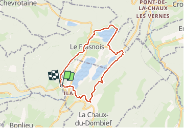
Positioning
Country:
France
Region :
Bourgogne-Franche-Comté
Department/Province :
Jura
Municipality :
Le Frasnois
Location:
Unknown
Start:(Dec)
Start:(UTM)
720656 ; 5166759 (31T) N.
Comments